The Marine Bird Distribution Working Group aims to support collaborative coordination of research and monitoring to increase knowledge of marine bird distributions in the U.S. Atlantic as described in the Working Group’s 2025-2027 workplan. The working group uses the best available science to improve our understanding of the effects of offshore development on marine bird species. This working group was formed in support of the RWSC’s Bird and Bat Subcommittee. The objectives of the working group include:
For more information on the efforts of this working group, including the group’s work plan, meeting summaries, and slide decks, visit the Marine Bird Distribution Working Group SharePoint. To get involved, please reach out to RWSC Bird & Bat Subcommittee Coordinator Zara Dowling ([email protected]).
The working group has compiled various existing resources related to the above objectives, including existing guidance for conducting surveys, key scientific literature on changes in marine bird distributions in relation to offshore development, species prioritization efforts, species distribution data.
Guidance for Pre- and Post-Construction Monitoring to Detect Bird Distribution and Habitat Use Change – Avian Displacement Guidance Committee
Guidance for Site Characterization Surveys
A synthetic analysis of post-construction displacement and attraction of marine birds at offshore wind energy installations – Lamb et al. 2024 Environmental Impact Assessment Review.
Seabirds and offshore wind farms in European waters: Avoidance and attraction – Dierschke et al. 2016 Biological Conservation.
A framework for studying the effects of offshore wind energy development on birds and bats in the Eastern United States – Williams et al. 2024 Frontiers in Marine Science.
Integrating movement models for individual tracking and species distribution data – Buderman et al. 2024 Methods in Ecology and Evolution.
RWSC Bird List – Information on various bird species for Atlantic states including species classification, distribution, protected statuses, offshore presence and movement, and references.
The relative vulnerability of migratory bird species to offshore wind energy projects on the Atlantic Outer Continental Shelf: An assessment method and database – Robinson Willmott et al. 2013. Note: As part of RWSC-funded research efforts, the Atlantic vulnerability assessment will be updated in 2026-2027.
Revised Marine Bird Collision and Displacement Vulnerability Index for U.S. Pacific Outer Continental Shelf Offshore Wind Energy Development – Kelsey et al. 2025.
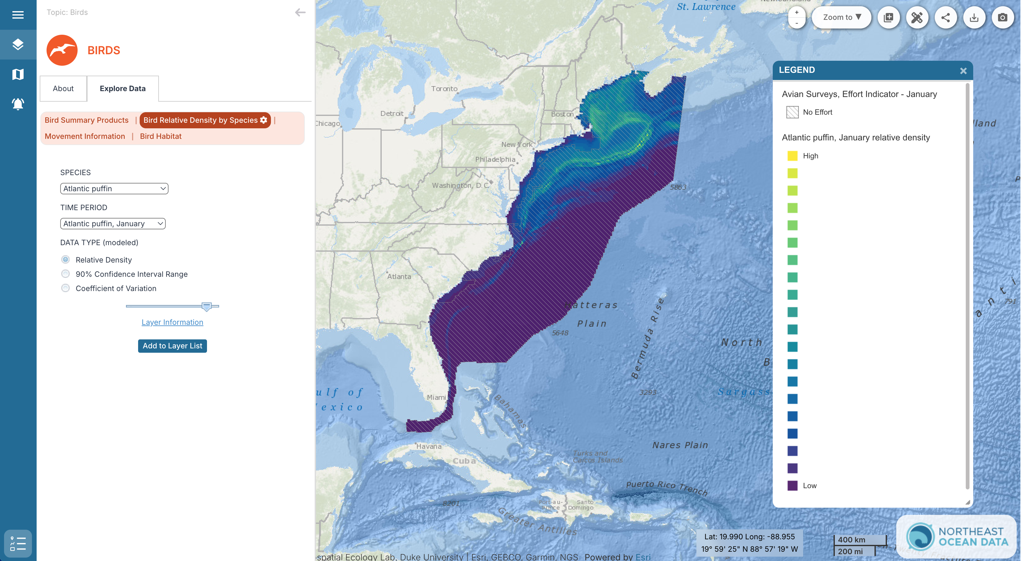
Modeling the distributions of marine birds at sea to inform planning of energy development on the US Atlantic Outer Continental Shelf – Winship et al. 2023
Seasonal maps of the spatial distributions of 49 marine bird species in U.S. Atlantic Outer Continental Shelf waters were developed using sighting survey data from over three decades from the Northwest Atlantic Seabird Catalog database along with Eastern Canada Seabirds at Sea data. These relative density maps can be used to aid ocean planning in the region and guide future data collection efforts. Data is available for download on the Northeast Ocean Data Portal.
OBIS-SEAMAP Data Repository – Duke University. A spatially, temporally interactive online database for marine mammal, sea turtle, seabird and ray & shark data from 2002-present. Note: The RWSC and Duke University are currently working to integrate the Northwest Atlantic Seabird Catalog into OBIS-SEAMAP to improve public accessibility. Stay tuned for more on this.